Ein Akab through the ruins of Abdat Ma’ale Debashon and ending at the Ben Gurion Tomb parking lot – a one-way route
(Rate)
X
היישוב הקרוב
רמת קושי
אורך
15 ק"מ
משך
7-8 שעות
עונה מומלצת
September-June
זמן מומלץ
Early morning
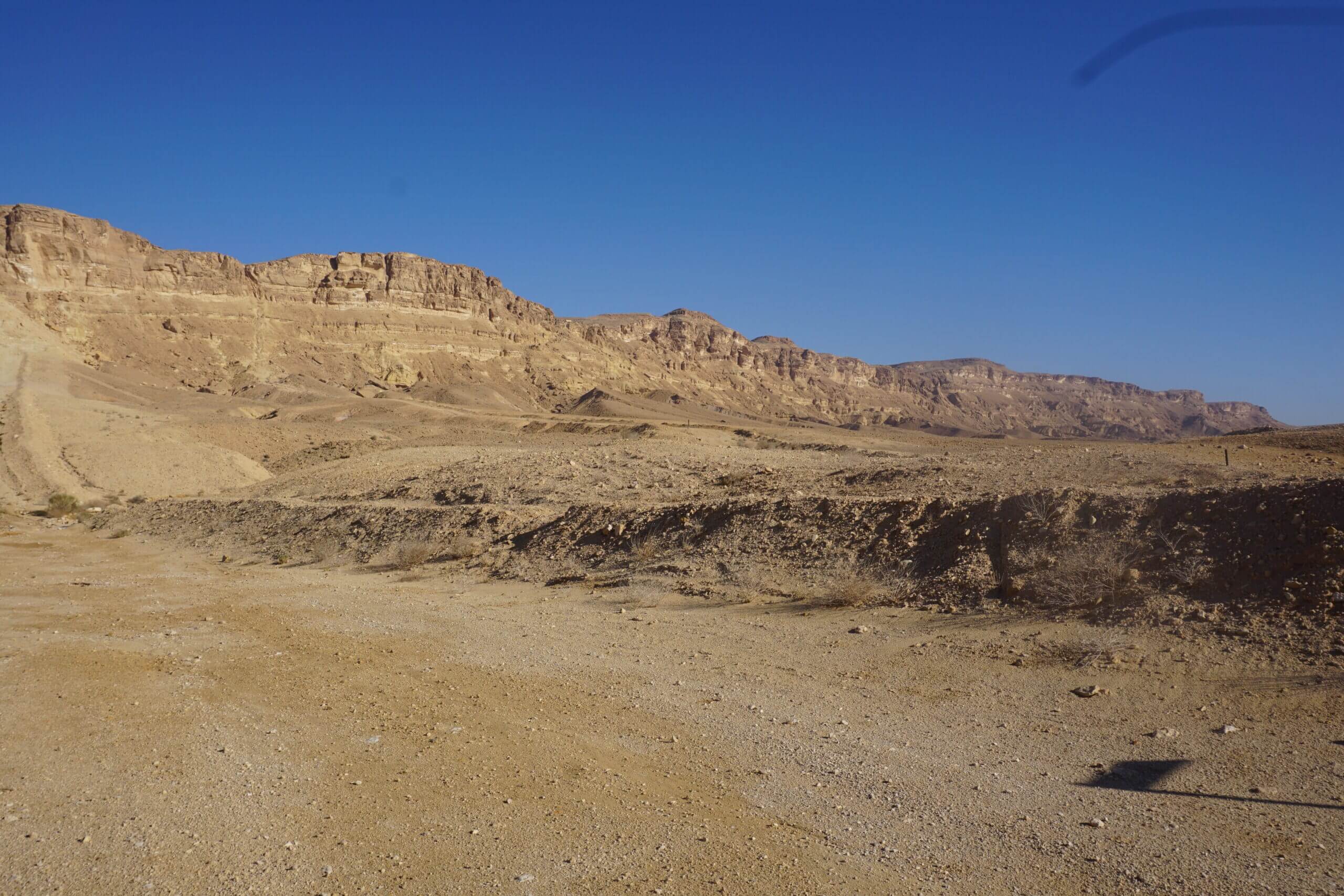
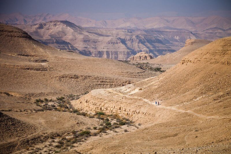
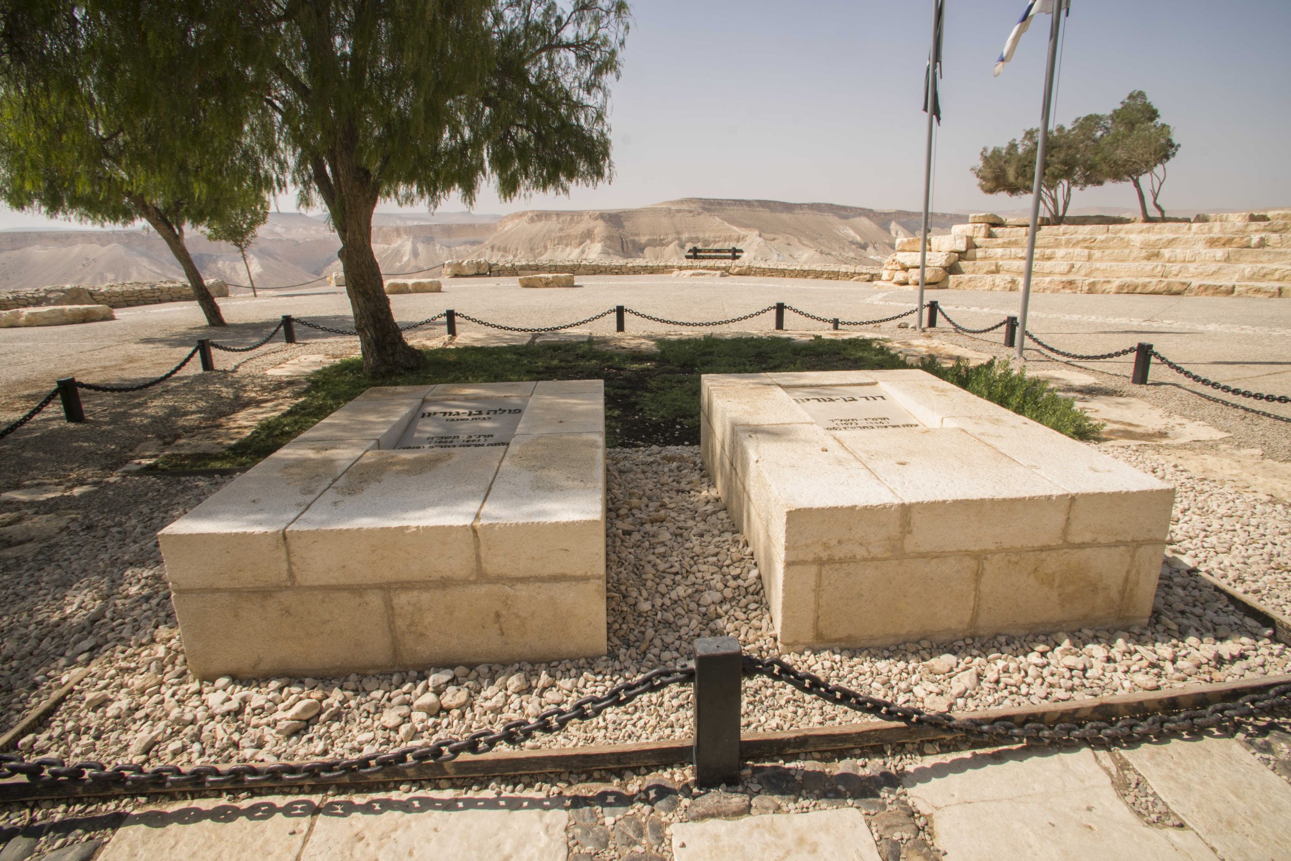
The beginning of the route is at the bus stop near the Avdat gas station, where we will connect to the blue marked path going north on the road with the gas station and the cafe on the right. From the bus station we will walk about 500 meters until the blue and purple paths split on the basis of a jeep road. At the split we will turn right on the blue marking and walk on a pedestrian path for about 800 meters, which will lead us to the splitting of paths with blue and green markings. Here we will continue with the blue marking towards the northeast. From the split we will walk about 4.9 km on the blue and purple markings (the Negev Mountain Trail) between wadis and chalk mountains typical of the area. It should be noted that the path pulls in a slight to moderate downward trend until we reach Nahal Aqab, Ein Aqab Upper and the split of the blue and black paths. At the split we will turn left and go up to the black marker on the Nahal Aqab route, where we will walk about 2.4 km until we come to the black, green and blue trail split and to the observation of Ein Aqab Lower. At the fork in the paths we will turn right at the blue markings (be careful going down towards the spring. The path is very smooth and there are pegs that help you get down safely). After wading in the spring we will return to the green marker at the top of the wadi (we climb back through the slippery pegs) and at the split of the green, black and blue paths turn right towards the northwest at the green marker, which will take us up a slight to moderate climb to the top of the plateau, where we will find the impressive view of the Horseshoe waterfall about 1.3 km From the fork in the road. From the Persa waterfall we will continue parallel to the cliff at the base of the green marking and sometimes we will see a purple marking (the Negev Mountain Trail) until after about 3.3 km we will recognize the head of Maale Dobashon, where we will begin a moderate to difficult descent for about 900 meters. At the bottom of it we will reach a fork in the road on an asphalt path, with Ein Abdat National Park on our left, Serpentinos overnight parking on our right and further on the cliff the Ben Gurion Synagogue juts out. It is recommended to go up to the seminary through a side path marked in medium to difficult red for about 500 meters which will bring us to the Ben Gurion Tomb parking lot to end the trip.